 Gloria Glover
 The Köppen system organizes world climates into five major groups—tropical, dry, temperate, continental, and polar—using temperature, precipitation, and seasonal patterns. These groups provide a consistent way to compare climate zones of the United States with regions around the globe.
Each code adds detail. The first letter identifies the broad climate group; later letters describe rainfall seasonality and temperature. For example, Cfa means a temperate climate with year-round precipitation and hot summers, while Dfb indicates a continental climate with no pronounced dry season and warm, rather than hot, summers.
How World Climates and Köppen Climate Types Are Defined
Köppen climate types are based mainly on monthly temperature averages, precipitation totals, and the timing of wet and dry seasons. The system uses thresholds that distinguish climates with similar annual averages but different seasonal behavior.
The second letter commonly describes precipitation: f means no dry season, s indicates a dry summer, w a dry winter, and m a monsoon pattern. In dry climates, BS identifies steppe and BW identifies desert. A third letter adds temperature detail, such as hot summer (a), warm summer (b), cool summer (c), or very cold winter (d).
The Five Major World Climate Groups: A, B, C, D, and E
- A—Tropical: Every month averages at least 18°C (64.4°F). Rainforest, monsoon, and tropical savanna climates occur near the equator.
- B—Dry: Evaporation generally exceeds precipitation. Deserts and semiarid steppes occur in subtropical belts, continental interiors, and rain shadows.
- C—Temperate: Mild midlatitude climates have warm or hot summers and winters that are cool but not persistently severe. Many have either year-round rainfall or a distinct dry season.
- D—Continental: These climates have greater seasonal temperature ranges, including cold winters and warm to hot summers. They are common in mid- and high-latitude interiors.
- E—Polar: The warmest month remains below 10°C (50°F). Tundra and ice-cap climates dominate the Arctic, Antarctica, and the highest mountain environments.
Climate Zones of the United States: Representative Types and Locations
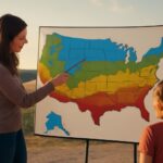
The United States includes examples of several major groups, although some occur only in limited areas. Tropical (A) climates occur in southern Florida and Hawaii, where warm ocean water prevents cold winters. Dry (B) climates cover much of the Southwest, including Phoenix, Las Vegas, and the Mojave and Sonoran deserts; mountain rain shadows and subtropical high pressure help maintain the dryness.
Temperate (C) climates appear along parts of the Pacific coast and across the Southeast. Portland has a generally dry-summer Mediterranean pattern, while Atlanta has a humid subtropical climate with hot summers and precipitation throughout the year. Continental (D) climates extend across the northern Plains, Great Lakes, Northeast, and interior mountain regions. Minneapolis and much of northern New England experience cold winters and substantial annual temperature ranges.
Polar (E) climates occur mainly in northern and high-elevation Alaska. Arctic Alaska has tundra conditions, while permanent ice occurs on the highest peaks and glaciers. High-elevation areas in the Rockies may also resemble polar climates locally, even where surrounding lowlands are dry or temperate.
Why U.S. Climate Zones Vary Over Short Distances
Latitude sets a broad temperature pattern, but local controls often change a climate classification within a short distance. Elevation lowers temperature and can increase snowfall. Mountain ranges force rising air to release moisture on windward slopes, leaving deserts in rain-shadow valleys. The Pacific Ocean moderates coastal temperatures, while the Gulf of Mexico supplies heat and moisture to the Southeast.
Distance from water also matters: inland areas heat and cool more sharply than coasts. Lake Superior and the Great Lakes modify nearby temperatures and enhance local snowfall, while ocean currents, prevailing winds, and slope orientation create additional boundaries between neighboring U.S. climate zones.