 Gloria Glover
 Climate zones are broad regions classified by long-term patterns of temperature and precipitation. They help us explain why equatorial forests, subtropical deserts, midlatitude grasslands, and polar ice occur in different parts of the world. A climate zone also provides a useful starting point for understanding where people grow food, build settlements, manage water, and change local environments.
These zones describe usual conditions over many years, not a forecast or a single unusual season. On a map, boundaries are general because climate changes gradually across landscapes and can vary with elevation, coastlines, and mountain ranges.
What Defines Climate Zones—and How They Differ From Daily Weather
Scientists define a climate zone using long-term averages and patterns, especially temperature, precipitation, and the timing of wet and dry seasons. A period of about 30 years is commonly used to calculate climate normals. The result shows what conditions are typical, including seasonal variation and the likelihood of extremes.
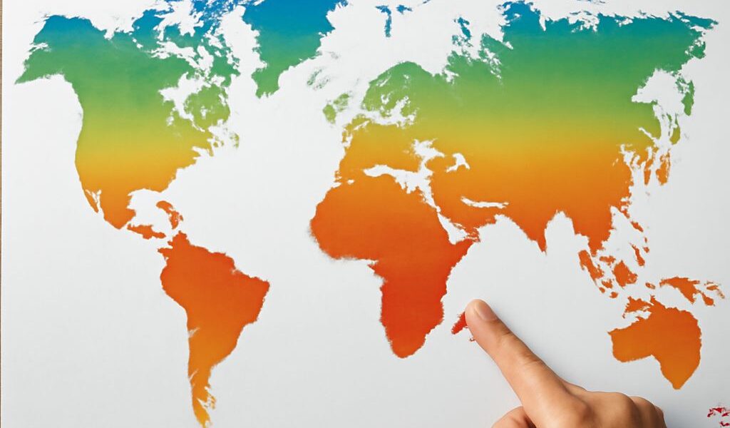
Latitude is an important starting point. Places near the equator receive more direct sunlight throughout the year, while polar regions receive less concentrated solar energy. However, latitude does not determine everything. Elevation, prevailing winds, ocean currents, distance from the sea, and mountain barriers can make nearby places have very different climates.
Daily weather is temporary. A snowstorm in a usually mild city does not turn that city into a polar climate zone, just as one hot afternoon does not make a cool region tropical. Climate describes the long-term pattern behind many days, seasons, and years of weather.
How to Read a World Climate Map
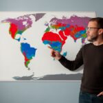
When we read a world climate map, we should first study its legend. Colors may represent broad groups such as tropical, dry, temperate, continental, polar, and highland climates. Some maps use more detailed systems, including subdivisions based on seasonal rainfall or average temperatures.
Look for broad geographic patterns rather than perfectly precise borders:
- Latitude: Tropical climates generally form a belt around the equator, while polar climates occur near the Arctic and Antarctic.
- Continents and oceans: Coastal areas often have milder temperatures than inland areas because water heats and cools slowly.
- Relief: Mountains can force moist air upward, producing rain on one side and dry rain-shadow conditions on the other.
- Elevation: Highland climates can occur in the tropics, temperate zones, or near the poles because temperature generally falls with altitude.
Map users should also compare the climate pattern with physical geography. For example, a dry region may appear beside a subtropical high-pressure belt, deep inside a continent, or behind a mountain range. The map shows the dominant pattern, while local conditions may differ within the same mapped area.
The Major Types of Climates and Where They Occur
The major types of climates are commonly grouped by heat and moisture:
- Tropical: Found near the equator, including much of the Amazon Basin, central Africa, and Indonesia. Temperatures stay warm year-round, while rainfall may be constant or strongly seasonal.
- Dry: Located in deserts and semiarid regions such as the Sahara, Arabian Peninsula, central Australia, and parts of the southwestern United States. Evaporation often exceeds precipitation.
- Temperate: Common in many midlatitude coastal areas, including western Europe, parts of eastern China, New Zealand, and the Pacific Northwest. These regions may have mild winters, warm summers, or distinct dry seasons.
- Continental: Concentrated mainly in the interiors and eastern portions of large Northern Hemisphere continents, including Canada, eastern Europe, and northern China. Summers and winters can differ sharply.
- Polar: Found in the Arctic, Antarctica, Greenland, and other high-latitude areas. Temperatures remain low for much of the year, and vegetation is limited by cold and short growing seasons.
- Highland: Occurs in elevated areas such as the Andes, Himalayas, and Ethiopian Highlands. Conditions change rapidly with altitude, slope direction, and exposure.
These categories are not isolated boxes. A temperate region may contain dry interior valleys, and a tropical mountain may have cool conditions at high elevations. A detailed climate zone system identifies those smaller differences.
Human-Environment Interaction Examples: Adaptation and Environmental Change
These human environment interaction examples show two different relationships. Adaptation means people adjust their activities or buildings to existing conditions. Environmental change occurs when human actions alter land, water, ecosystems, or atmospheric conditions.
- Tropical climates: In flood-prone parts of Bangladesh and Southeast Asia, raised homes, drainage systems, rice cultivation, and cyclone shelters help people adapt to intense rainfall and seasonal flooding. Clearing forests for farms, roads, or cattle pasture is an environmental change that can reduce habitat, increase erosion, and alter regional water cycles.
- Dry climates: Communities in North Africa and the Middle East use irrigation, wells, water storage, and drought-tolerant crops to support settlement and agriculture. Irrigation can also cause soil salinization, lower groundwater levels, and shrink rivers or wetlands when water use exceeds natural replenishment.
- Temperate climates: Farmers select crops and planting dates suited to seasonal temperatures, while cities such as those in the Netherlands use dikes, pumps, and flood barriers to manage water. Expanding paved surfaces creates urban heat islands and increases runoff, changing local environmental conditions.
- Continental climates: Insulated buildings, heating systems, grain storage, and short-season crops help communities manage cold winters and variable growing seasons. Mining, intensive farming, and urban expansion can remove vegetation, fragment habitats, and pollute soil or water.
- Polar and highland climates: People use specialized clothing, strong insulation, seasonal travel routes, and carefully timed grazing or farming. Roads, tourism, dams, and resource extraction can damage fragile tundra or mountain slopes, where ecosystems often recover slowly.
A climate zone therefore influences human choices without completely determining them. Technology, infrastructure, culture, wealth, and government decisions also shape how people respond—and whether their activities protect or transform the environments in which they live.